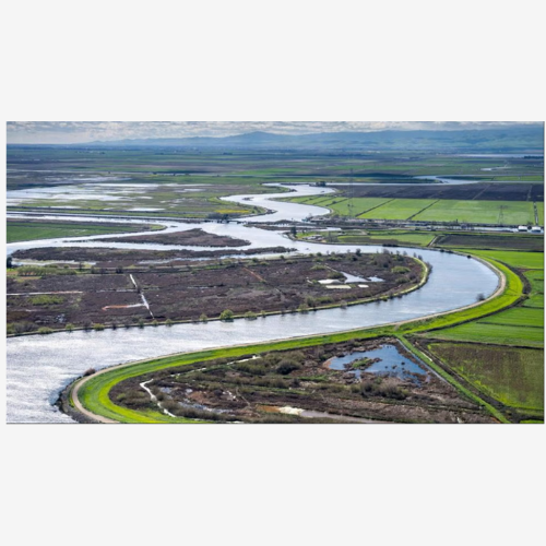
The Sacramento–San Joaquin Delta is one of California’s critical water supply regions, protected by an extensive levee system that is increasingly vulnerable to both flood and seismic hazards. Levee failure could have cascading consequences for water infrastructure, ecosystems, and the vulnerable communities living behind them. This research focuses on building a framework to integrate seismic vulnerability assessment of levees with regional flood risk modeling and social impact analysis. Over the summer, I began collecting, processing, and digitizing geotechnical data from levee subsurface explorations, applying spatial interpolation methods to model soil conditions, and initiating preliminary work necessary for running flood simulations. These methods will help quantify where levees are most at risk during earthquakes and how failures could impact surrounding communities. Complementing this technical work, I collaborated with former GMS fellow Adrienne Dodd on fieldwork in Pajaro, a small agricultural town that suffered two major floods in 2023, including a levee break. Through surveys and interviews with residents and business owners, we documented concerns about uncertainty, displacement, and gaps in risk communication. By connecting lessons learned from Pajaro with engineering analyses in Sacramento, this project aims not only to improve levee vulnerability assessment but also to develop more effective tools for communicating flood risk to vulnerable communities, ultimately strengthening urban resilience in flood-prone regions.
Strengthening Urban Resilience: Regional Flood Risk Analysis and Simplified Seismic Vulnerability Assessment of Levees in the Sacramento-San Joaquin Delta